


Wasserläufe
Sauer
Alle Pegelstände
Sûre

 Wiltz
Woltz-Clerve
Ernz Blanche
Our
Ernz Noire
Wiltz
Woltz-Clerve
Ernz Blanche
Our
Ernz Noire
Alzette
Mosel
Maas
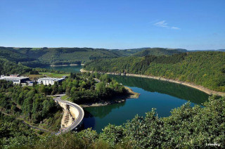
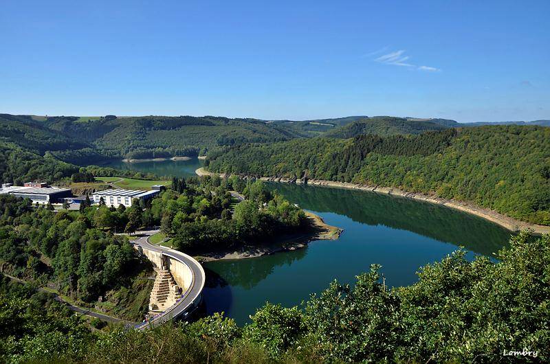
Stationsdetails: Barrage Esch-Sauer / Sûre
| Stationsdetails | |
|---|---|
| Name | Barrage Esch-Sauer |
| Wasserlauf | Sûre |
| Einzugsgebiet am Pegel | 428,0 km² |
| Nullpunkt | m NN. |
| Flusskilometer | 97,57 km |
| Koordinaten (LUREF) | 62378 E | 108634 N |
| Anrufbeantworter | (+352) 24750-884 |
| Rezenteste Messdaten | |||
|---|---|---|---|
| Datum | 12.07.2025 | ||
| Zeit | 04:15 | 04:30 | |
| Wasserstand | 314,60 m NN. | 314,60 m NN. | |
| Differenz | 0,00 m NN. | ||
Wasserstand [m NN] in der Talsperre
- Maximal zulässige Füllung im Sommer: 320 m NN
- Maximal zulässige Füllung im Winter: 317 m NN
| Ergänzende Stationsdaten | |
|---|---|
| Inbetriebnahme | 01.07.2013 |
| Betriebszustand | In Betrieb |
| Betreiber | Administration de la gestion de l'eau |
| Berechnung der Vorhersage | Administration de la gestion de l'eau |
| Weitere verfügbare Informationen | |
| Hauptwerte | |||
|---|---|---|---|
| Für diesen Pegel sind keine Hauptwerte eingetragen. | |||
| Statistische Werte | ||
|---|---|---|
| Abfluss | Wasserstand | |
| Für diesen Pegel sind keine statistischen Werte eingetragen. | ||
| Historische Wasserstände | ||
|---|---|---|
| Datum | Wasserstand | Abfluss |
| Für diesen Pegel sind keine historischen Hochwasserstände eingetragen. | ||
Pegelbetreiber